Professional Workshops - November 21
GIS Day and Expo - November 22
University of Houston-Clear Lake – Bayou Building
2700 Bay Area Blvd, Houston, TX 77058
Last Update: March 26, 2024
Professional Workshops - November 21
GIS Day and Expo - November 22
University of Houston-Clear Lake – Bayou Building
2700 Bay Area Blvd, Houston, TX 77058
Last Update: March 26, 2024
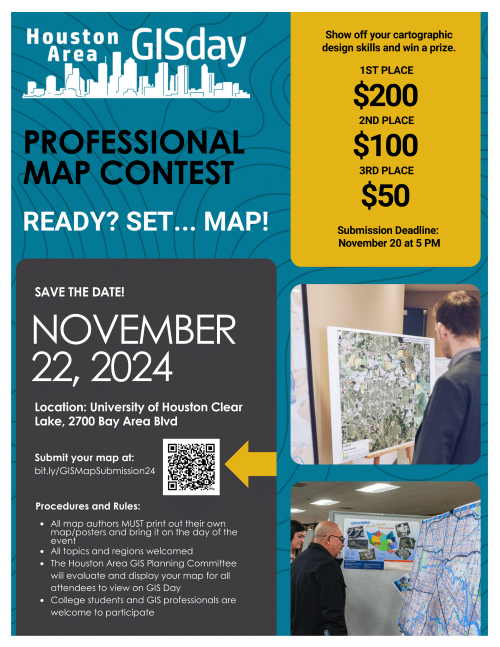
Enter The Professional Map Contest
For further questions contact this years Professional Map Contest Coordinators:
Patricia Michel at Patricia.Michel@h-gac.com and Soma Chatterjee at Schatterjee@sugarlandtx.gov.
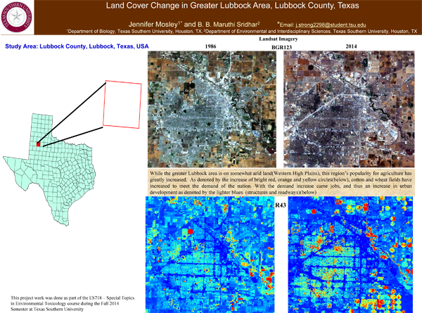
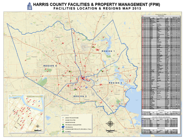
Congratulations to the winners!
![]()
The Geographic Data Workgroup (GDW) is an H-GAC sponsored group consisting of public, private, non-profit, and educational organizations. The group meets monthly to discuss Geographic Information System (GIS) related matters, network, and plan cooperative purchases of software, aerial imagery, and data that would be too costly if obtained separately.
City of Houston, Enterprise GIS
City of Pearland
City of Sugar Land
Fort Bend County Engineer's Office
Harris Central Appraisal District, GIS Maps
Harris Central Appraisal District, GIS Data Download
Harris County PID, Architecture & Engineering
Harris County Flood Control
Houston-Galveston Area Council
Montgomery County GIS
Rice University